“From farmland to floodplains, NISAR is set to change how we see Earth.”
Why These Images Matter
The release of the first images from the NASA–ISRO Synthetic Aperture Radar (NISAR) mission marks a turning point in Earth science. These are not just engineering checkouts—they are the first glimpse of a data stream that will soon help us monitor planetary change like never before.
With natural disasters and climate shifts intensifying, NISAR’s ability to detect tiny surface movements—globally, every 12 days, in any weather—makes it one of the most ambitious Earth-monitoring missions ever launched.
The NISAR Advantage: All-Weather, Precision Vision
At its heart, NISAR is a radar mission. Unlike optical satellites that take pictures using sunlight, it beams its own microwave signals toward Earth and measures the reflected energy. This allows it to see through cloud cover, smoke, and darkness.
Its unique power comes from two key features:
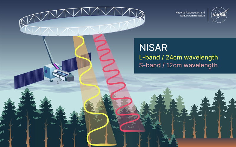
Penetrating Layers: NISAR’s L-band and S-band Radar
Dual-Frequency Radar: NISAR carries two radars that see the world in different ways:
-
L-band (24 cm wavelength): Penetrates vegetation canopies to monitor tree structure and see subtle ground deformations.
-
S-band (12 cm wavelength): Provides finer detail on surface characteristics like crop type and urban infrastructure.
Resolution & Polarization — at a glance: NISAR will image Earth’s surface at resolutions between ~3 and ~25 meters, depending on the imaging mode — fine enough to reveal fields, city blocks, and many landscape features. It also transmits and receives radar waves in multiple orientations (HH, HV, VV, VH). These polarization combinations let the radar distinguish how different surfaces scatter energy — helping to separate forests from farms, wetlands from dry land, or healthy crops from stressed ones.
Unprecedented Accuracy: By combining these frequencies, NISAR will detect surface movements as small as centimeters, creating a time-lapse movie of our dynamic planet.
Key Insight: “NISAR isn’t just taking pictures; it’s measuring change. It’s the difference between a photograph and a ruler.”
Decoding the First Images: A Proof of Concept
These initial images, acquired in August 2025, confirm the satellite’s systems are working as planned. They already reveal details critical for environmental monitoring.
Image A: Mount Desert Island, Maine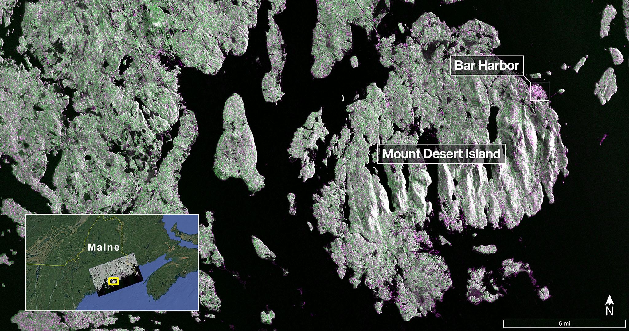
NISAR’s L-band view of Maine’s coast. Green indicates forest; magenta shows hard surfaces like buildings and bare ground; dark areas are water. (Image: NASA/JPL-Caltech)
What We See: The image clearly resolves the town of Bar Harbor (magenta), forested areas (green), and intricate waterways and small islets. The ability to see such fine detail (down to 5 meters) is crucial.
Why It Matters: This precision is foundational for coastal and ecosystem monitoring. It allows scientists to track shoreline erosion, map wetland loss, and monitor forest biomass with exceptional accuracy—all essential for climate resilience planning.
Image B: Farmlands of North Dakota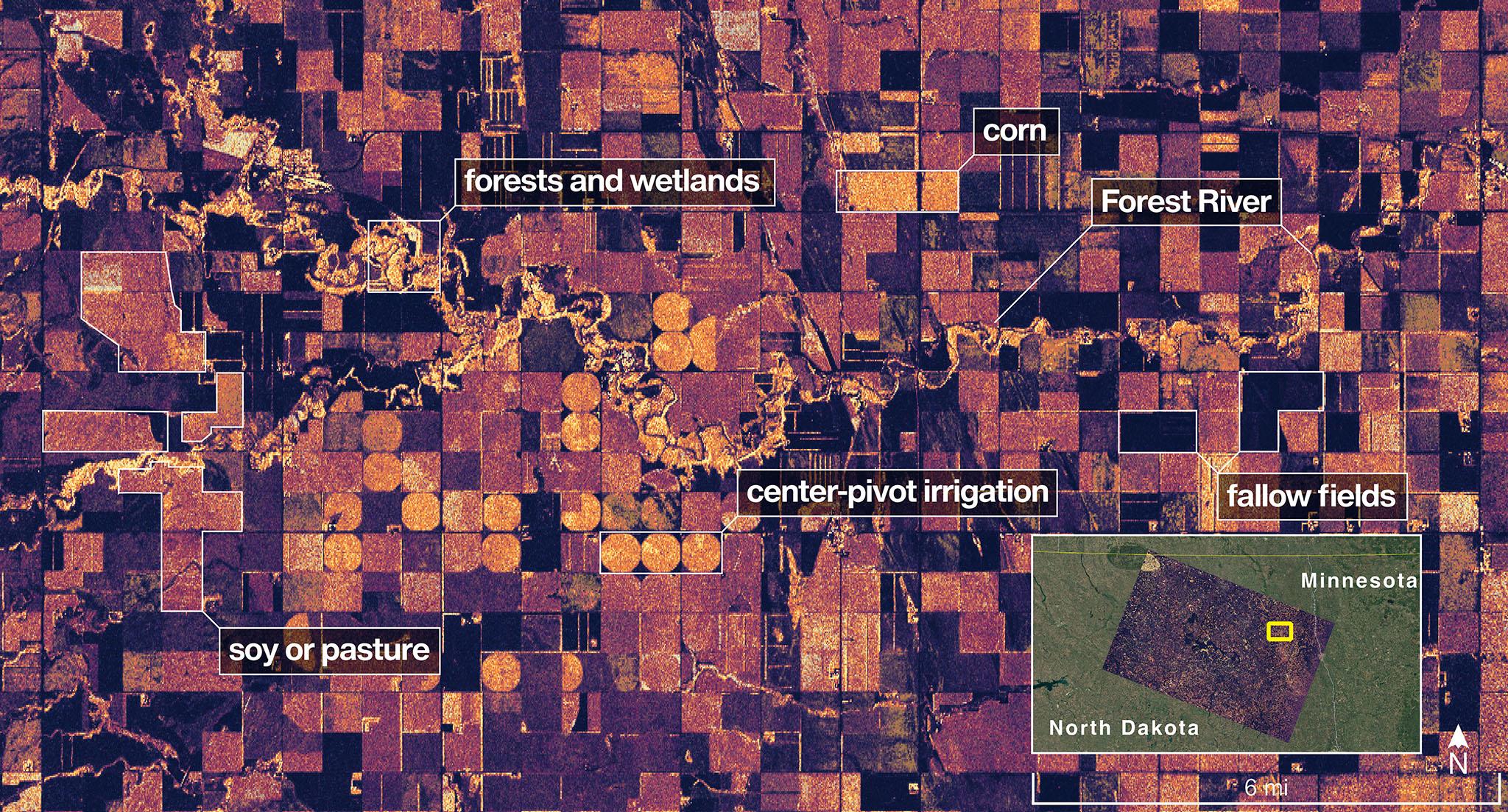
Caption: NISAR’s view of agricultural land in North Dakota. Circular patterns are center-pivot irrigation systems; dark plots are fallow fields; lighter areas indicate crops.
What We See: The image shows the Forest River winding through wetlands, surrounded by a mosaic of agricultural fields. The technology clearly distinguishes between different land uses.
Why It Matters: This demonstrates NISAR’s immediate utility for agriculture and water resource management. It can monitor soil moisture and crop growth stages continuously, even during cloudy seasons, providing data for food security forecasting and sustainable water use.
Beyond the Pixels: How NISAR Data Drives Real-World Decisions
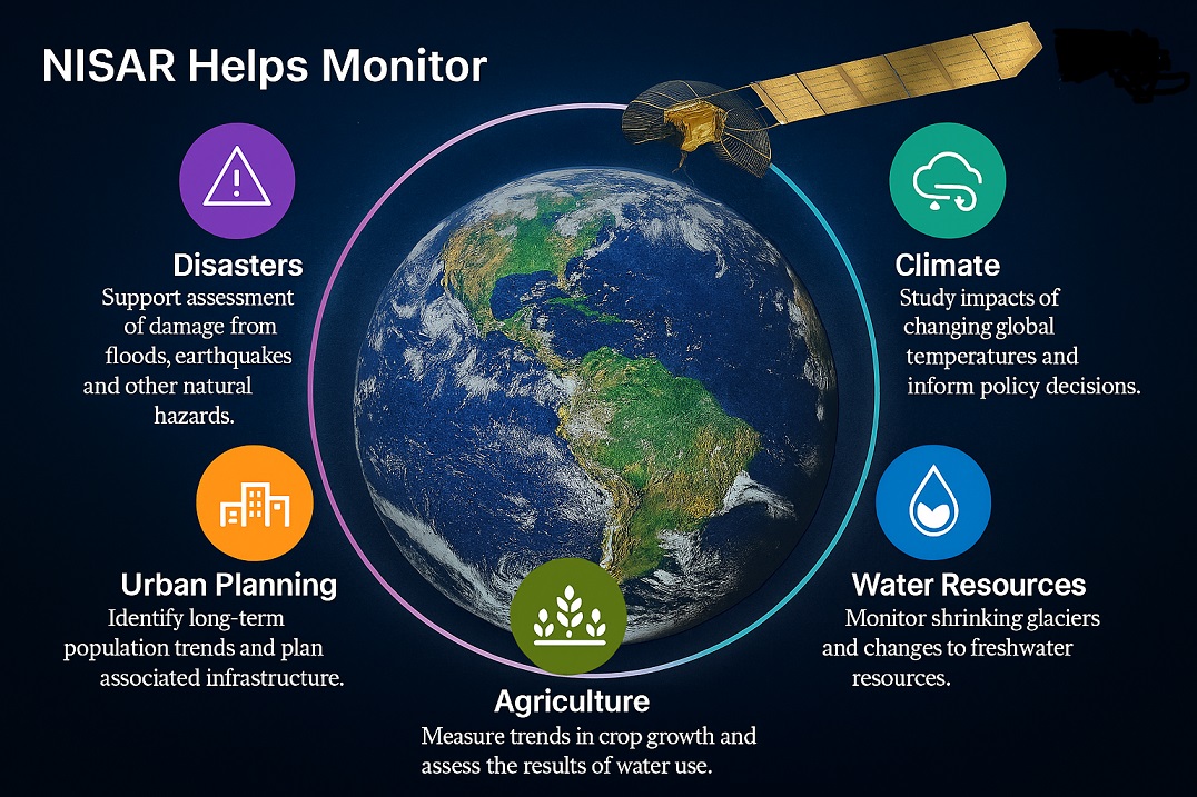
NISAR’s open data policy means its insights will be freely available, fueling innovation across numerous fields. Here’s how different sectors will benefit:
-
Disaster Management: Map landslide risks and measure ground uplift before volcanic eruptions. Enable rapid flood mapping during cyclones, regardless of cloud cover.
-
Climate Science: Track the velocity of glaciers and the stability of ice sheets, directly improving sea-level rise models. Global mapping of forest biomass is vital for understanding the carbon cycle.
-
Agriculture & Food Security: Monitor crop health and soil moisture to support precision farming and improve yield predictions globally.
-
Urban Planning & Infrastructure: Detect millimeter-scale subsidence in bridges, dams, and cities to monitor structural health and plan resilient infrastructure.
-
Water Security: Observe changes in groundwater reserves and soil moisture to improve drought and flood management strategies.
The Data Revolution: A Foundation for Global Innovation
The true power of NISAR lies not in a single image, but in the relentless, predictable flow of data it will provide. This creates a new foundation for understanding Earth.
-
A Continuous Record: Imaging the entire planet every 12 days creates a consistent, comparable time series, turning single observations into a story of change.
-
A Universal Tool: The value of this open, global dataset will be unlocked by users far beyond traditional science. It will empower software developers creating new applications, journalists reporting on environmental issues, and students learning about our planet.
-
Informed Futures: This data will provide the hard evidence needed to guide decisions—from local farmers managing water to international bodies tracking climate agreements.
Conclusion: A New Lens on a Changing Planet
NISAR is more than a satellite; it’s a public utility for Earth intelligence. Its first images confirm that the mission is on track to deliver on its promise. The challenges of the 21st century—from climate change to resource scarcity—require a new level of planetary awareness. NISAR will provide the consistent, high-fidelity data we need to navigate them, fostering a deeper understanding of our world and enabling smarter, more resilient societies.
The era of continuous, precise planetary monitoring is about to begin.

Very insightful!
This is informative content about the NISAR satellite. Thank you Ajith.
A promising step to India’s space capabilities. Thanks Ajith