
The Tale of Two Cities: Decoding Urban Blueprints with OpenStreetMap Data
"Walk across Chandigarh and you sense order; walk across Delhi and you feel centuries of growth." 1. Two Cities, Two...
Read More
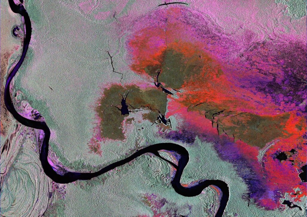
Mapping Earth’s Pulse: NASA-ISRO’s NISAR Satellite Delivers First Images
“From farmland to floodplains, NISAR is set to change how we see Earth.” Why These Images Matter The release...
Read More

The Pink Transformation of India’s Meteorite Lake: Tracking Changes with Satellite Imagery
Introduction Lonar Lake in Maharashtra, India, is a rare geological marvel formed by a meteorite impact over 50,000 years ago....
Read More

Resilience Unveiled: Investigating Forest Fire Regeneration using Geospatial Techniques
Watch our YouTube video below showcasing the incredible transformation of a tropical forest as it is ravaged by fire...
Read More
GEO visualization – GIS day 2022
Our planet, Earth, is unique in our known universe. As the only planet with water and life, it is a...
Read More

Exploring Geospatial Data with Kepler.gl
“The power of data visualization is that, it can generate clear and actionable insight from datasets, even complex in...
Read More

How to create a Satellite Time Lapse Animation?
Time Lapse animation created from satellite imagery can give us sight of changes in earth over a period of time....
Read More
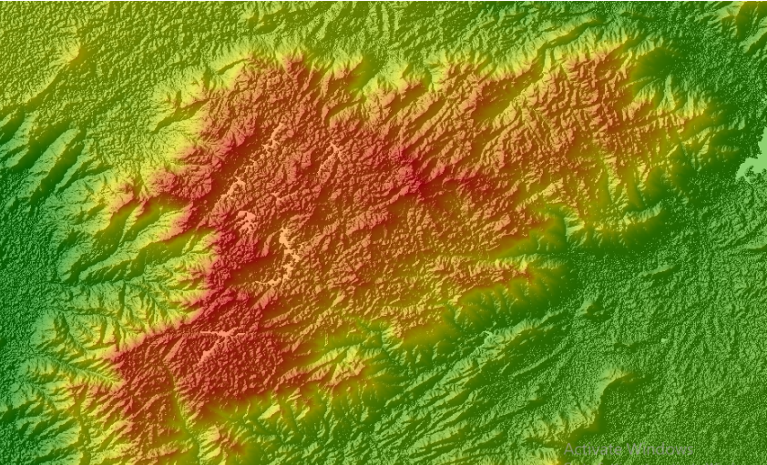
Download SRTM DEM Using Google Earth Engine Explorer
A Digital Elevation Model (DEM) is a 3-dimensional representation of the elevation of a terrain, usually in raster file format....
Read More