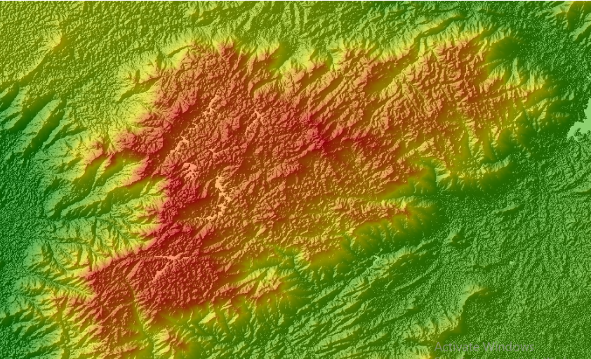
A Digital Elevation Model (DEM) is a 3-dimensional representation of the elevation of a terrain, usually in raster file format. DEM can be used for various purposes such as hydrological modeling, terrain visualization and analysis, engineering and infrastructure designs, and more. Some of the most commonly used freely available DEMs are ASTER GDEM and SRTM DEM, which can be downloaded from official websites and other sources. However, users are often required to download a full tile of DEM, even if they need data for a relatively small area.
In this post, we will provide a step-by-step guide on how to download SRTM DEM using Google Earth Engine Explorer. Google Earth Engine Explorer is a web application for exploring the vast amount of freely available geographic data stored in the Google Earth Engine Catalogue. In addition to searching for various types of earth observation datasets, the tool also allows users to import, run simple analysis, and save and export the result.
To download SRTM DEM using Google Earth Engine Explorer, follow these steps:
- Sign up for Google Earth Engine Explorer using your Google account here
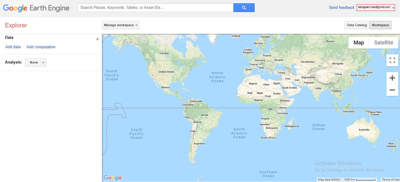
- Zoom in to your area of interest by using the search bar or scrolling your mouse wheel.
- Search for “NASA SRTM Digital Elevation 30 m” in the search bar.
- Your search result will be added to the Table of Content on the left side of the screen. Also, a pop-up will appear on the screen. Here, you can change options to get a better visualization of your area of interest.
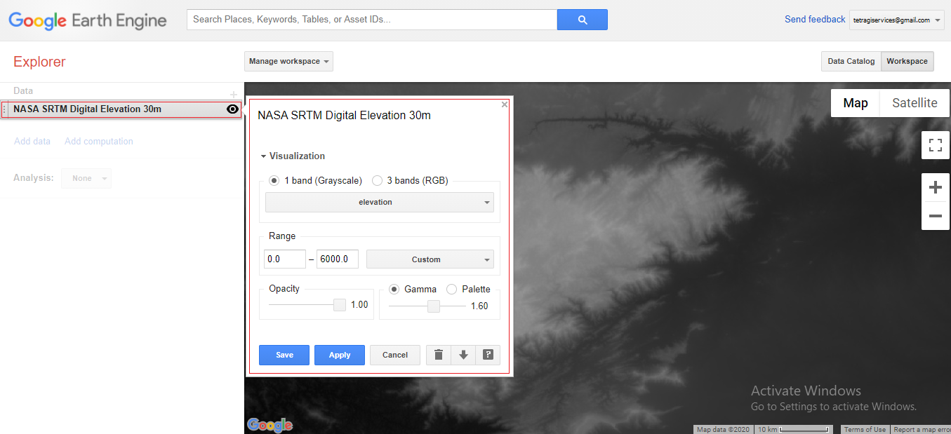
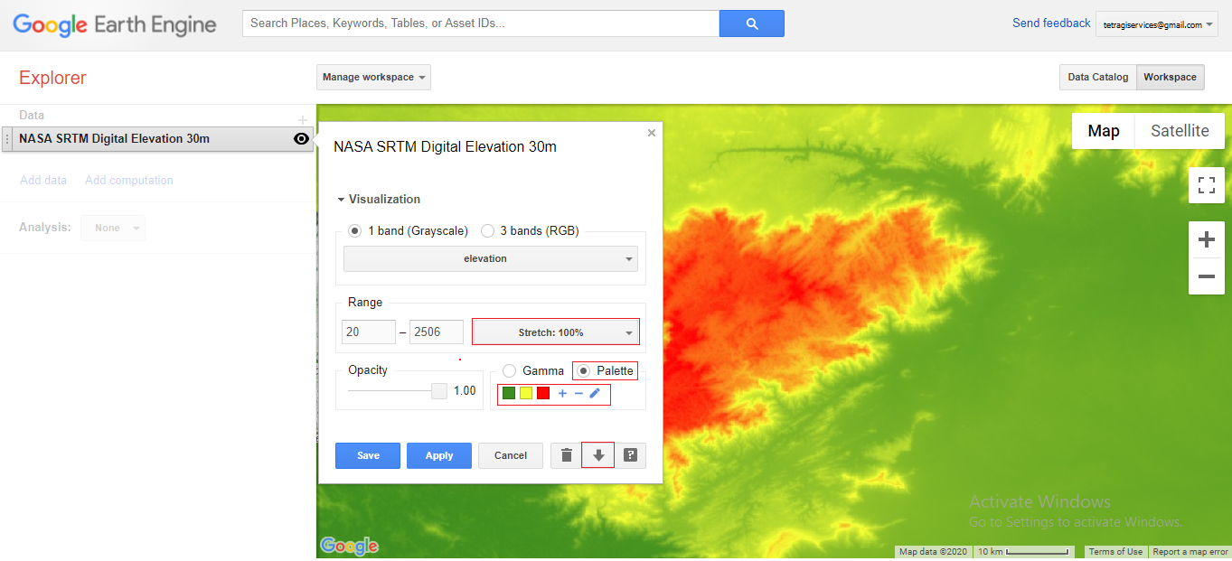
- Change the default visualization parameters using the palette option if required.
- Click on the “download layer” option.
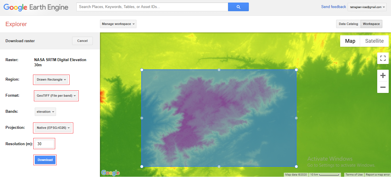
- Click on the “Viewport” button to choose either a polygon or rectangle to select your area of interest.
- Choose an appropriate file format. Also, if necessary, you can change the projection. Change the resolution to 30 m.
- Click on the “Download” button to download your data.
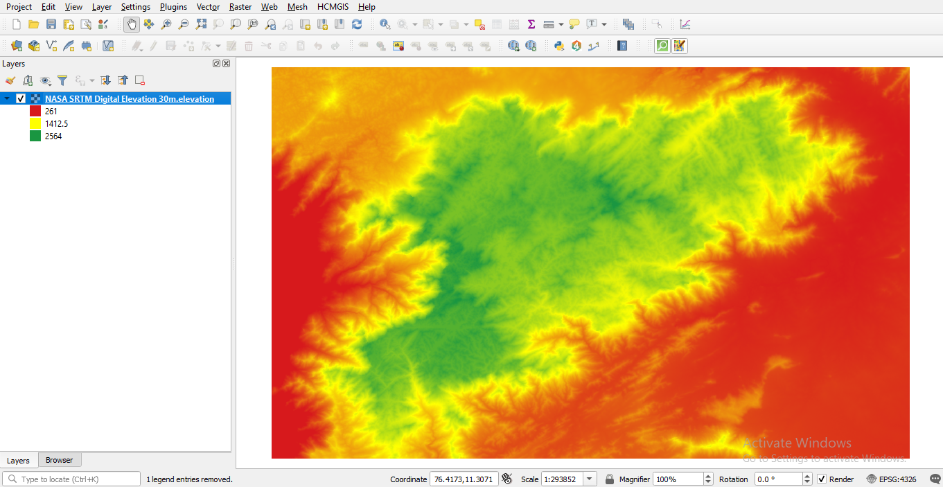
- Unzip your data and open it in your favourite GIS software for further analysis.
The post explains how to download a Digital Elevation Model (DEM) of a specific area of interest using the Google Earth Engine Explorer. It first introduces what a DEM is and some commonly used freely available DEMs. Then, it explains what Google Earth Engine Explorer is and its features. The post then gives step-by-step instructions on how to download SRTM DEM using Google Earth Engine Explorer. Finally, it suggests unzipping the downloaded data and using it in a GIS software for further analysis.
Thanks for your blog, nice to read. Do not stop.